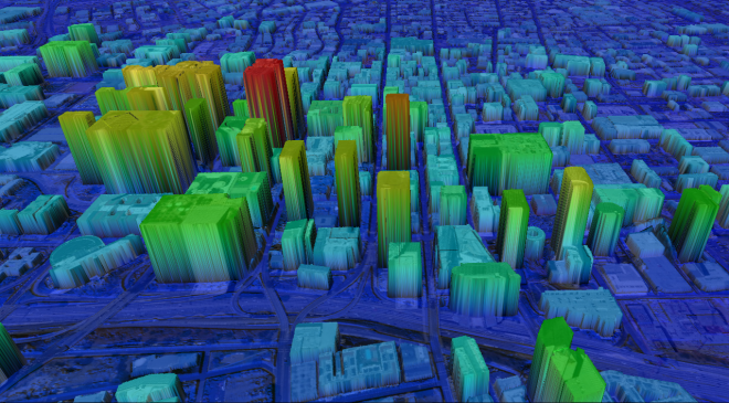
Collecting Airborne IFSAR for Southeast Asian Government Agency.
Malaysia’s federal mapping agency plans to map their sovereign territory on the island of Borneo, the largest island in Asia and the third largest in the world. Intermap, a geospatial content development and intelligence solutions provider was chosen by the Government to complete mapping the program. This will be the second mapping project in Malaysia for and its seventh deployment to Borneo, including previous mapping projects for Indonesia’s territory on the island.
In Borneo, Intermap will use its proprietary sensor technology to collect airborne IFSAR imagery and create 3D digital elevation models (3D DEMs) and 3D-derivative feature products to build authoritative base maps for the island. The Company will deploy its recently upgraded multi-frequency radar to collect cloud-free imagery and detect features through dense tropical canopy. These unique sensors operate beyond the visual range of the electromagnetic spectrum, providing situational awareness not available from narrow-spectrum cameras. To further maximize information content from its 3D models, Intermap will deploy proprietary IRIS™ technology to create DEMs with advanced multi-sourced pixel integration, delivering superior data products quickly, accurately and economically. The extracted content layers will be combined to form high-resolution topographic base maps, supporting planning and development.
Intermap’s sensors and technology collect 25-centimeter resolution IFSAR imagery and produce 1-meter resolution DEMs and feature products, including full triple canopy foliage penetration, for foundational base maps at better than 1:5,000 scale in harsh terrain environments. Using artificial intelligence and machine learning algorithms, the Company’s patented IRIS engine automatically extracts primary features from multi-sourced data, including high-frequency and low-frequency radar, multi-spectral imagery, LiDAR, satellite SAR, optical sensors, aerial photo and other sources, in near real-time, to assist in identifying and monitoring changes in features, objects and hybrid vectors.
Topographic maps and their derivatives are vital for national planning and development, such as security design, sovereign border enforcement, urban and rural development, search and rescue, disaster management, flood forecasting and warning, taxation, natural resource management, tourism and sustainability planning. Operations for this contract will employ local personnel, including for advanced project responsibilities such as data processing, field surveys and project management. A series of training courses will be conducted to help government users understand, employ and deliver some of the world’s most advanced geospatial imagery, DEMs, feature products and software tools.
Intermap provides imagery and 3D elevation models, feature and vector data extraction and software tools. It’s suitable for large-scale base mapping in difficult and austere environments, particularly where in regions of the world where optical LiDAR and other SAR sensors are inhibited by near-permanent cloud cover, rainfall or dense jungle canopy.


