South Asian countries work with Google on predictions and alerts.
Flooding is the most common natural disaster on the planet, affecting the lives of hundreds of millions of people around the globe and causing around US$10 billion in damages each year.
In collaboration with Yale, Google has been visiting flood-affected areas and doing research to better understand what information people need, how they use it to protect themselves, and what we can do to make that information more accessible. One survey we conducted found that 65 percent of people who receive flood warnings before the flooding begins take action to protect themselves or their assets (such as evacuating or moving their belongings).
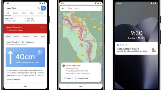
But Google also found there’s a lot more we could be doing to help—including getting alerts to people faster and providing additional information about the severity of floods.
Google technology is being used to improve targeting of every alert the government sends. It has been working the International Federation of Red Cross and Red Crescent Societies and aims to build local networks that can get disaster alert information to people who wouldn’t otherwise receive smartphone alerts directly.
The technology company has also been working with the Bangladesh Water Development Board to bring our warnings and services to Bangladesh, which experiences more flooding than any other country in the world.
To enable this, Google has devised an inundation modelling, called a morphological inundation model, which combines physics-based modelling with machine learning (ML) to create more accurate and scalable inundation models in real-world settings.
The alert-targeting model allows identifying areas at risk of flooding at unprecedented scale using end-to-end machine learning models and data that is publicly available globally.